
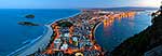
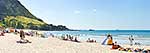
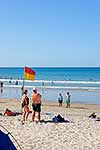
 stock photo.")
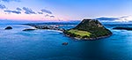
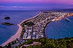
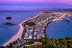
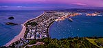
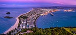
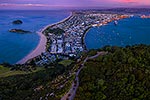
Mt Maunganui, or Mauao, at the Tauranga Harbour Entrance. 231m high lava dome. Moturiki Island at left, Tauranga Port cenre, City right. Aerial panorama at dusk, Mount Maunganui, Tauranga District, Bay of Plenty Region, New Zealand (NZ), stock photo.
- Location:
- Mount Maunganui (other locations)
- District:
- Tauranga (see districts)
- Region:
- Bay of Plenty (see regions)
- Country:
- New Zealand (NZ)
- Notes:
- Large file (9475 x 4949 pixels native, no interpolation). | Ratio (height:width) 1:1.91
- Photographer:
- Rob Suisted
- Image #:
- 62878OP00
Keywords (advanced)
Related images


Similar images
Random images


")