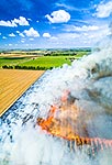
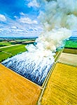
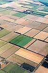
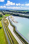
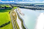
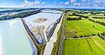
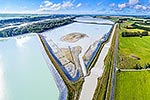
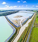
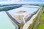
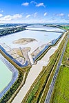
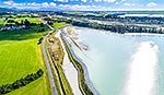
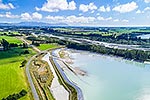
Rangitata South Irrigation Scheme water storage reservoirs or ponds beside the Rangitata River, used to irrigate surrounding farmland. Aerial view, square format, Arundel, Timaru District, Canterbury Region, New Zealand (NZ), stock photo.
These images are protected by copyright, but we license them to suit your needs. Click
'quick quote' to learn more...
Rangitata South Irrigation Scheme water storage reservoirs or ponds beside the Rangitata River, used to irrigate surrounding farmland. Aerial view, square format, Arundel, Timaru District, Canterbury Region, New Zealand (NZ) Stock Photo
Rangitata South Irrigation Scheme water storage reservoirs or ponds beside the Rangitata River, used to irrigate surrounding farmland. Aerial view, square format, Arundel, Timaru District, Canterbury Region, New Zealand (NZ)
 stock photo.")


")