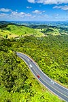
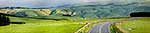
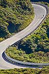
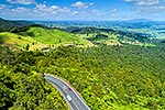
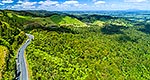
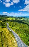
State Highway 29 (SH29) and traffic climbing the Kaimai Ranges from the Waikato Plains towards the Bay of Plenty. Aerial view, square format, Kaimai Range, Matamata-Piako District, Waikato Region, New Zealand (NZ), stock photo.
These images are protected by copyright, but we license them to suit your needs. Click
'quick quote' to learn more...
State Highway 29 (SH29) and traffic climbing the Kaimai Ranges from the Waikato Plains towards the Bay of Plenty. Aerial view, square format, Kaimai Range, Matamata-Piako District, Waikato Region, New Zealand (NZ) Stock Photo
State Highway 29 (SH29) and traffic climbing the Kaimai Ranges from the Waikato Plains towards the Bay of Plenty. Aerial view, square format, Kaimai Range, Matamata-Piako District, Waikato Region, New Zealand (NZ)
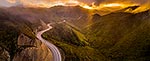
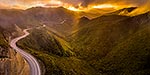
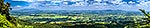
 and traffic climbing the Kaimai Ranges from the Waikato Plains towards the Bay of Plenty. Aerial view, square format, Kaimai Range, Matamata-Piako District, Waikato Region, New Zealand (NZ) stock photo.")
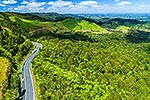


 and traffic climbing the Kaimai Ranges from the Waikato Plains towards the Bay of Plenty. Aerial view, square format, Kaimai Range, Matamata-Piako District, Waikato Region, New Zealand (NZ)")