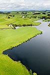
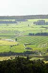
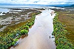
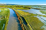
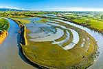
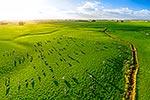
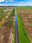
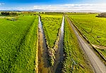
Dairy farming on waterlogged coastal soils near Karamea at high tide. Channels drain water from hump and hollow farmland into tidal creeks. Aerial view, Karamea, Buller District, West Coast Region, New Zealand (NZ), stock photo.
These images are protected by copyright, but we license them to suit your needs. Click
'quick quote' to learn more...
Dairy farming on waterlogged coastal soils near Karamea at high tide. Channels drain water from hump and hollow farmland into tidal creeks. Aerial view, Karamea, Buller District, West Coast Region, New Zealand (NZ) Stock Photo
Dairy farming on waterlogged coastal soils near Karamea at high tide. Channels drain water from hump and hollow farmland into tidal creeks. Aerial view, Karamea, Buller District, West Coast Region, New Zealand (NZ)
 stock photo.")


")