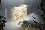
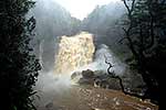
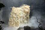
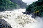
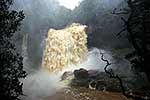
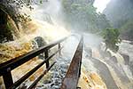
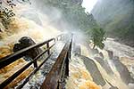
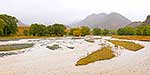
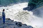
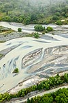
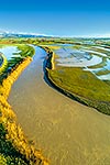
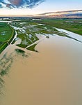
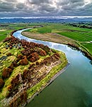
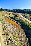
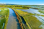
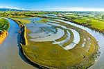
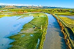
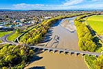
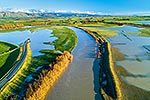
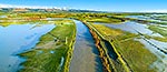
Farmland flooded by the Manawatu River and winter storm. State Highway 56 (SH56, left) and dairy farmland inundated by flood waters. Aerial view looking south towards Tararua Ranges, Opiki, Horowhenua District, Manawatu-Wanganui Region, New Zealand (NZ), stock photo.
These images are protected by copyright, but we license them to suit your needs. Click
'quick quote' to learn more...
Farmland flooded by the Manawatu River and winter storm. State Highway 56 (SH56, left) and dairy farmland inundated by flood waters. Aerial view looking south towards Tararua Ranges, Opiki, Horowhenua District, Manawatu-Wanganui Region, New Zealand (NZ) Stock Photo
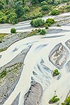
Farmland flooded by the Manawatu River and winter storm. State Highway 56 (SH56, left) and dairy farmland inundated by flood waters. Aerial view looking south towards Tararua Ranges, Opiki, Horowhenua District, Manawatu-Wanganui Region, New Zealand (NZ)
 and dairy farmland inundated by flood waters. Aerial view looking south towards Tararua Ranges, Opiki, Horowhenua District, Manawatu-Wanganui Region, New Zealand (NZ) stock photo.")


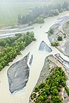
 and dairy farmland inundated by flood waters. Aerial view looking south towards Tararua Ranges, Opiki, Horowhenua District, Manawatu-Wanganui Region, New Zealand (NZ)")