
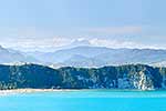
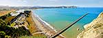
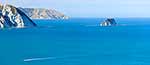
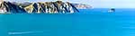
 and Marau Point. Mt Hikurangi (1752m) distant centre left. Panorama, Tolaga Bay, Gisborne District, Gisborne Region, New Zealand (NZ) stock photo.")
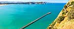
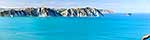
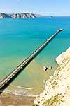
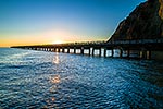
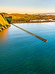
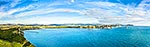
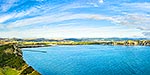
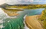
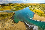
Tolaga Bay from the Uawa River mouth across to Te Karaka Point (and island) and Marau Point. Mt Hikurangi (1752m) distant centre left. Panorama, Tolaga Bay, Gisborne District, Gisborne Region, New Zealand (NZ), stock photo.
 EMAIL TO FRIEND
- Location:
- Tolaga Bay (other locations)
- District:
- Gisborne (see districts)
- Region:
- Gisborne (see regions)
- Country:
- New Zealand (NZ)
- Notes:
- Massive file (27352 x 4066 pixels native with no interpolation) | Ratio (height:width) 1:6.73
- Photographer:
- Rob Suisted
- Image #:
- 49516OP00
Keywords (advanced)
Related images


Similar images
Random images
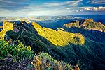
 and Marau Point. Mt Hikurangi (1752m) distant centre left. Panorama, Tolaga Bay, Gisborne District, Gisborne Region, New Zealand (NZ)")